The MBIE Funded Research Programme He Tātai Whenua: A Te Ao Māori landscape classification involves implementing a Te Ao Māori landscape classification that can be directly integrated with existing geographical information systems (GIS). This type of new classification, which is the first for an indigenous group, describes an interpretation of landscape features from the Māori indigenous people, and used as Māori metrics-based Landscape Classification for New Zealand directly into GIS. Currently, the descriptors and datasets in the GIS systems in classifying NZ’s environment are based on frameworks with no inclusion or recognition of mātauranga Māori. Since Maori interpretation of landscape features are well recognized, this project focuses on three main components:
- Development of Maori landscape classification criteria based on mātauranga Māori, tikanga, kaitiakitanga and tohu taiao from leading Maori academics and Iwi partners
- Generation of the first Maori Landscape Classification GIS (MLC-GIS) and database using new IT, GIS, remote sensing techniques and mathematical methods to visualize landscapes based on the developed criteria.
- Application of the MLC-GIS alongside existing environmental databases in new catchment management strategies.
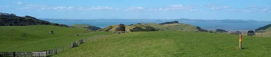
By using the Manawatu catchment, protocols will be developed to include a new classification of Maori Landscape Classification GIS which will cover the whole of New Zealand. The new geospatial visualization methods will be the first of its kind for indigenous people and will have a significant international impact.
Particular areas within this theme that we are working on include the use of unpersonned aerial vehicles (UAVs) for multiple applications; hyperspectral scanning for precision agriculture and 3D scanning to create building models.
Our Team
Our research team is predominantly Māori, meaning that the research will be carried out by Māori, with Māori, for the benefit of all New Zealand. This unique team has the broad range of expertise, ranging from Māori art to mathematical modelling, required to develop our proposed Māori landscape classification system. Members of the team have strong iwi connections, significant professional experience and considerable academic backgrounds.
Professor Jonathan Procter and Associate Professor Hone Morris co-lead the project.
Professor Procter (Muaupoko) has considerable expertise in geomorphological research, particularly remote sensing and GIS, also mātauranga Māori and environmental management.
Associate Professor Morris (Ngāi Te Rangitotohu, Ngāti Mārau) is an expert in Te Reo Māori, with research interests in linguistics and historical narratives. He is also extremely well connected with local iwi in Manawatū.
Garth Harmsworth (Te Arawa, Ngāti Tūwharetoa, Ngāti Raukawa) has three decades of experience in land resource assessment, national environmental databases, GIS applications, and indigenous research. Mr Harmsworth is one on the foremost experts in Māori landscape classification in the country, and has long been involved with the development of systems to better integrate Māori knowledge and science.
Ngataiharuru Taepa (Te Ati Awa, Te Arawa), Kaihautu Toi Maori (Director of Maori Arts) in Massey University’s College of Creative Arts, is an expert in Māori visual culture. Mr Taepa’s expertise will be critical in extracting landscape classification data from representations in Māori art forms.
Dr Margaret Forster (Rongomaiwāhine, Ngāti Kahungunu), Dr Gail Tipa (Ngāi Tahu) and Dr Jessica Hutchings (Ngāi Tahu) are active at the interface of science and Māori knowledge. With interests related to Māori relationships with whenua, they each have expertise in environmental management, Māori culture and development and policy. These researchers will guide the collection and interpretation of Māori cultural knowledge, and the translation to science compatible metrics.
Dr Peter Meihana (Ngati Kuia) is a recognized expert in Maori history. Dr Meihana’s expertise will be utilised in gathering and interpretation of Māori cultural knowledge, he brings an additional professional perspective to the project.
Dr Kristin Stock, Dr Gabor Kereszturi and Mr Stuart Mead have critical expertise in geoinformaics and spatial modeling. Dr Stock, in particular, researches the extraction of geographic data from natural language and methods to automatically interpret natural language descriptions of location. Dr Stock’s expertise will enable the development of metrics for constructing a GIS information layer.
Dr Joy Panoho (Ngāpuhi) has research and professional expertise engaging at the interface of Māori knowledge and western knowledge systems. Dr Panoho’s experience translating information between different knowledge systems will be critical to ensuring that Māori knowledge is appropriately translated to scientific data.
Dr Simon Hills (Ngāti Porou) is an early career researcher with expertise in biology, particularly ecology. Dr Hills will have responsibility in the interpretation and translation of biological data within the project.
Six researchers from each of the six main Iwi groups in the Manawatu catchment case study region will be engaged on the project. This will ensure that the project is firmly embedded in local stakeholder Hapu/iwi. Key personnel from local councils will be engaged to ensure that the datasets generated will be fit for use by local government bodies, and to facilitate uptake of the project outcome. We will train PhD and Masters students, preferably Māori, in integrative research at the interface of Māori knowledge and science.
Project Outputs
Stock, K., Morris, H.W., Forster, M., Paraku, R. and Egorova, E. (2019). He Tatai Whenua: Automated Extraction of Landscape Terms and their Meanings in New Zealand Maori. Geocomputation 2019 – Adventures in GeoComputation, 18-21 September, Queenstown, New Zealand.
Stock, K., Morris, H.W., Forster, M., Paraku, R. and Egorova, E. (2019). He Tatai Whenua: An Exploratory Analysis of Landscape Terms in the New Zealand Maori Language. Conference on Spatial Information Theory: COSIT 2019, 10-13 September, Regensburg, Germany (poster).